| |
trayson
Member
|
Posted: Dec 6, 2010 Post Subject: When do they release Fordyce flow plans? Want flow education!! Post Subject: When do they release Fordyce flow plans? Want flow education!!
|

|
| Hey Chris, it seems that you have the inside line to the PGE person that can tell what's up with Fordyce flows.
There's a group of us that are looking at planning a summer 4x4 trip there in 2011. Oviously, for crossings in our Jeeps, we like the lower flows.
I've learned by reading this site that at a certain point in the summer, they cap the flows to build up reservoir storage.
I'd like to get a better understanding of the different variables that factor into flows... I have to imagine that snowpack and runoff have a lot to do with it? We did a trip there in late June 2008, and your graph confirms that flows were quite low. Really low for almost all of 2008. Then I look at your graph for 2010 and it scares the heck out of me because there's some really significant flows happening over the summer of '10. What happened in 2008 that made it so low? What happened in 2010 that made it so high?
And I've read in older threads where you give PGE forecasts for flows. When do you get that info?
My understanding is that flows under 250 are prefered for us Jeep water crossing folks. And yes, I know about the decrease in flows specifically for the Sierra Trek, but I'm sure that you can understand that trying to do that trail with a huge influx of people is less than desireable for those of us that prefer to not have the trails look like the mall on Christmas Eve or a grocery store on the night before thanksgiving...
I would LOVE to have a discussion about what factors come into play for flows in the area.
Thanks,
Trayson
BTW, these are the types of "waterfalls" that get us rock crawlers excited:

Taken 2008 on the Fordyce Creek trail.
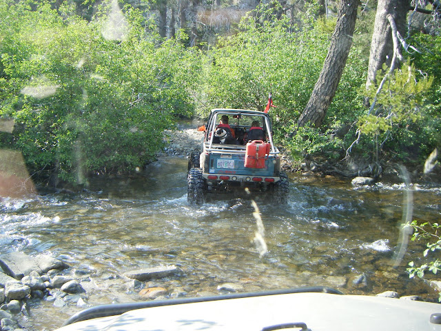
And here was one of our incredibly uneventful 2008 water crossings...

|
chris
Site Admin
|
| Nice pics. But to answer your questions (or try to). Yes, I used to have a direct inside line to PG&E for Fordyce flows, but no longer. American Whitewater has taken on that role. So I now go through AW.
I'm not sure what all goes into PG&E's decision making, but yes things like current reservoir level, snowpack, expected precipitation, and commitments are major ones. Fordyce doesn't do power generation, but it does feed Spaulding, which feeds the Bear River, which does both power generation and water for downstream communities. They drop the flows for the Sierra Trek, set them to the specified level for flow studies, and they have to draw the reservoir down at the start of winter. I expect for the rest they release what seems like a good idea at the time, based on known requirements at that time - which can change. Perhaps they must chop the flow due to some electrical or mechanical failure, or they raise the flow (to draw the reservoir down) since they need to do construction, or some community needs less or more water or power, etc. So we see a flow graph that's all over the place. I don't know of any way to predict next year's flows from here, and strongly doubt PG&E has much of an idea themselves yet.
To answer your other question - American Whitewater (or their representatives) get flow predictions when they ask for them. Since that's a hassle and they're busy, and since the news is almost always bad from a boating perspective, my contacts usually don't unless asked. But if you have a specific need let me know (email to chris@dreamflows.com would be the most efficient and easiest for me, though post here on the BB too if you have the time) and I'll pass the request on. The reply can take days, so be sure to ask ahead of time.
| | | |
![]()